Last modified: September 7, 1998.
Assembled & maintained by :
Sankalpa
Old Maps of Calcutta/Bengal: 16th - 19th Century
|
Last modified: September 7, 1998. |
Assembled & maintained by : |
||||||
|
Sankalpa |
|||||||
|
Old Maps of Calcutta/Bengal: 16th - 19th Century |
|||||||
|
1. Bengal in the 18th century (with an inset showing the important centers along the Hooghly River) |
|
2. Conjectural map of Calcutta at the time of the British advent, taken from 'Calcutta: Society and Change; 1690 -1990, by Samaren Roy, 'Introduction'. |
|
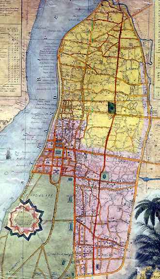
3. Plan of Calcutta, engraved by M M Woollaston, 1825, taken from 'Calcutta: City of Palaces', by J P Losty; back cover. |
|
|
![]()
![]()
![]()